Kneemap POH 0.7.0
-
Airbases icons finished…
Continue with MEF edition.
Open image in another windows to view full size:

-
What a beauty!!! BRAVO Joe, you are making great things buddy and i love all of them :p!
Don’t forget to check again the data of the airports due to the updated NavAids.
Stay at the same tempo…
Nikos. -
why don’t u go digital - Interactive? Like Red-Dog’s.
HOT LIST

System Specs:
i7-2600K @ 4.8 Ghz WaterCooled / 32GB Ram. 128GB SSD/1TB SSD / GTX1080Ti 11GB DDR5X / HOTAS COUGAR. TrackIR 4 / 3x24" Mon. (res:5760x1200) / Cougar MFD's / Wheel Pedals / Win 10 64 bit.

-
why don’t u go digital - Interactive? Like Red-Dog’s.
For some main reasons:
I do not know how to make interactive maps.
I have no more time to learn to do them.
And especially because we have other priorities (from POH 0.8.0 and later):
Include objects in two shooting range (BARDENAS and Alcochete)
Create objects to 18 airbases 100% photorealistic (buildings, runways, taxi ….) and make them operational
Create a campaignThanks for your understanding
-
Uhm I just noticed that Covilha (LPCV) is still included. In real life it has been demolished and is now a huge telecom datacenter (maybe a nice campaign target?). Is it still too late to change this?
-
Uhm I just noticed that Covilha (LPCV) is still included. In real life it has been demolished and is now a huge telecom datacenter (maybe a nice campaign target?). Is it still too late to change this?
Thank you for the heads up. You are correct.
Joe, i also checked and confirmed this, Covilha (LPCV) is not yet active airport.
So we can delete it from the “te_new.tac” and the cam files.
Do that with the rest corrections that i was sent you yesterday ;).
Nikos. -
Roger Wilco!!!
")
-
-
well it’s quite simple since u have the files and the icons… It’s a simple action on mouse over an area to display a menu and then select an action that will point to another page where it will display the map photo data maip airport diagram whatever u have ready for each airport.
It can work online like RedDog’s if u have hosting space or u could via free cloud space or offline by downloading. I’m sure it’s a piece of cake for a web designer if u provide him the files, and Icons to use them as mouse over triggers.
-
Thank you very much for your indications dear friend. As you say appears to be a simple job. Once finished the Kneemap think it would be interesting to look for volunteers for this task.
-
well it’s quite simple since u have the files and the icons… It’s a simple action on mouse over an area to display a menu and then select an action that will point to another page where it will display the map photo data maip airport diagram whatever u have ready for each airport.
It can work online like RedDog’s if u have hosting space or u could via free cloud space or offline by downloading. I’m sure it’s a piece of cake for a web designer if u provide him the files, and Icons to use them as mouse over triggers.
:mrgreen:
Yep, quite easy for a web designer. -
you guys are talking nonsense.
things are always easy when you don’t have to do it")
the interactive maps are not easy to do,even when you know how to design website.
it takes a lot of time to ensure that all the info match and are coherent throughout all the different modules: charts, map, ui map, terrain, coordinates etc etc
and even if you know how to program html and java, you still have to input a lot of data by handyou can believe the word of the guy who makes them !!
-
Red Dog u r talking about creating them also.
The guys are making them, I’m talking about bundling them presenting them under WEB.
This doesn’t need any data or coding.
It’s just one page with as many buttons on it as many the airports are.
Once u create one the rest are just the same u just change the filenames and links.
If displaying the menu as in your wonderful maps is difficult, wanting some code maybe, well can be done and via another page that will contain the options, like 1. airport diagram 2.NOTAM 3.xxx 4.yyyy.
I believe we can leave with it and it would be way faster then having to search and find the file or page if it’s a pdf with all the info or scattered files - pics etc.With now days apps this can be done very easily from dreamweaver to corel web designer…
Sure needs time if u have many info - files but it’s mostly a repetition work then doing something new from scratch.
With my knowledge level (way looow) on the subject doesn’t sound difficult to start build it, meaning to structure it. Difficult will be to have the patience to finish it. Most of it is what’s called tedious (?) work.
The time guys spent to draw what was drawn on the map above could be used to make a very good start to make it Interactive. This if they already knew how to do it, meaning there was a guy with knowledge and time to do it.
-
-
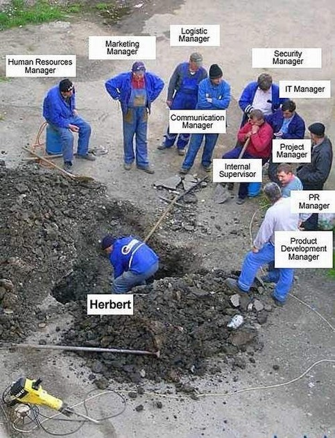
yeap… :lol: also reminds the joke of look and learn how the hard work (sewers) is done cause else u will only carry the tools and stay outside…
HOT LIST
System Specs:
i7-2600K @ 4.8 Ghz WaterCooled / 32GB Ram. 128GB SSD/1TB SSD / GTX1080Ti 11GB DDR5X / HOTAS COUGAR. TrackIR 4 / 3x24" Mon. (res:5760x1200) / Cougar MFD's / Wheel Pedals / Win 10 64 bit.
-
i do them with Dreamweaver, but the airport data are still inserted by hand in the code !!
onclick="return overlib('N 36°41.72 / E 127°19.84
Elevation: 26 ft
Runway 02L/20R - 02R/20L
Tacan 052X
Tower UHF: 353.10
Tower VHF: 136.75
<a <="" pre="">And if you do both VFR and Hi map, you need to do it twice because it's a double page which is a pain to maintain in double

and i'm talking only about the interactive map, not creating them which is even more tedious as Joe knows :)

> With my knowledge level (way looow) on the subject

enough said ;-)</a>
Red Dog
Reality if for ppl who can't handle simulation -
The time guys spent to draw what was drawn on the map above could be used to make a very good start to make it Interactive. This if they already knew how to do it, meaning there was a guy with knowledge and time to do it.
I have both, but the way he builds his system his data is locked into his format. I don’t want to have to recreate all his work, but if someone else wants to do the legwork I can build a working interface easily.
-
I saw that RedDog via Fierefox Inspector and to tell u the truth I went huh? geo coordinates on a web page onclick event?
But I’m sure u know more then me. I use those building apps and just see the result… I don’t bother much about the code underneath. If it works ok if not try…But as I see it this command is what is shown in the menu on click… if u have an excel sheet with those data (I’m sure there is one) u can create those command lines in a snap with concatenate… to help u ease the load.
So since u r more knowledgeable on the subject I rest my case…
HOT LIST
System Specs:
i7-2600K @ 4.8 Ghz WaterCooled / 32GB Ram. 128GB SSD/1TB SSD / GTX1080Ti 11GB DDR5X / HOTAS COUGAR. TrackIR 4 / 3x24" Mon. (res:5760x1200) / Cougar MFD's / Wheel Pedals / Win 10 64 bit.
-
@Red:
i do them with Dreamweaver, but the airport data are still inserted by hand in the code !!
onclick="return overlib('N 36°41.72 / E 127°19.84
Elevation: 26 ft
Runway 02L/20R - 02R/20L
Tacan 052X
Tower UHF: 353.10
Tower VHF: 136.75
<a <="" pre="">And if you do both VFR and Hi map, you need to do it twice because it's a double page which is a pain to maintain in double

and i'm talking only about the interactive map, not creating them which is even more tedious as Joe knows :)

enough said ;-)</a>
<a <=“” pre=“”>This is because you’re doing it wrong. If you had all of this code in a database and a proper front end GUI setup for it, you could write one function to display the data for each mode and then just pass in the DB variables, as many of them as you wanted, and it would be very easy to maintain because you would only have to change the underlying data.
How about this. I will set up the page, and give everyone a form for entering data. If they want to do the DB insertion, then they can build a useful tool, I will give them the framework to do it.
If he does have an excel sheet, and sends it to me, I can throw it into a DB in about two seconds.
Image maps, just like Dreamweaver, went out of Vogue in about 1997, largely for the reasons you mention above. Namely, maintainability.</a>
-
This is because you’re doing it wrong
First,
I never said i do this right
i do it with the capability i have at my disposal, i certainly am not a web engineer or an IT guy
and whatever way you turn the problem, it will remain hard work. even if you can code it correctly.Second
there is always a guy to tell you are doing it wrong
there’s not only one way to do things
if it’s stupid but works, it ain’t stupid and last i checked, the interactive map worksi have seen multiple great coded app nobody can use because they are not documented well enough because coders don’t document their stuff, especially in the falcon world.
If he does have an excel sheet, and sends it to me, I can throw it into a DB in about two seconds.
2 seconds, my foot
It doesn’t take a web engineer to convert a xls spreadsheet to a db. i can do that on my ownBut the data in falcon is constantly changing, at this time i maintain twos for korea:
one for 432, one for 433 and even if i wanted to share that work, you fail to understand that it takes years to place all fixes at the correct spot. and then a new codes comes in for the tacan and you have to start from the ground up because all the coordinates were screwed and you need to start all over again. Because if you move the navaid station, you move all the fixes and the coordinates !!just please understand you guys only see the visible part of the iceberg, it took quite a bit of time to get there.
in the process, quite a few helping hands disappeared and it’s very rare to find someone able to keep up in the long run.what you want is have the hard part made for you and then just put the cherry on the cake.
Even if it 's a lot of work for me, and even if it’s the wrong way for you - once the hardest part is done, i actually enjoy putting the cherry on top as wellUp to now, only Joe Labrada had the guts to try on his own, And Nikos for the charts.
They have my respect.
All the rest in this discussion are just talking and criticizing and not doing anythingRed Dog
Reality if for ppl who can't handle simulation

