
Best posts made by Lukas
-
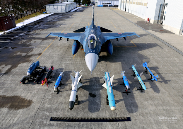
RE: Effective Use of AIM-7sposted in General Discussion
When F4.0 came out, it was generaly active missile promo.
DB was/is set this way: Active missiles are usefull, close range heaters too. Semiactive weapon is useless trash.
Its about braking the lock by chaffs, ECM, range, seeker limit…then kinematics and radal gimbal fight - this part is really fun, but usually its just plain stupid “chaff, chaff, chaff…supported with some beaming…no lock, missile ballistic”.
Now I am speaking F4 in general - if bandit has no chaffs and ECM, semiactive missiles are really good. If bandit has chaffs/ECM, its just a lottery (dont know latest BMS improvements very good).
Cos I have used MiG-21/23 (29) a lot in FF, OF (later BMS) and AF, I can tell the only chance for good use of semiactive Advanced Atoll and Apex (Alamo too) is to gain speed, get as close as possible and fire it in hardlock mode of course. Sometimes u can kill something. There was also some dirty tactics vs AI - when missile was launched, it made them turn…but I dont like this aproach.
I did some historic missions in various theaters and for example F4 with Sparrows is really strong against MiGs without chaffs. The same F-14, where Sparow is good between heaters and Phoenix…I also loved to use MIG CAP ALPHA only.
It should work in Sparrowed F-16 too (Egypt, Iraq…)To have some more interresting old style BVR I tried to mod semiactive missiles. If they were set as active class, but without any own radar, they were much better (with the same FM). It was really fun. It made even AA-9 usefull and “re-lockable”…lock was broken even few times in very long BVR.
Lately I let them by default, but modded CM…to get interresting old style F-4, F-14, F-15 vs MiG-21,23(29) cinematic/gimbal limit 3D BVR scenarios. It’s something the average Falconer won’t experience. Fun to watch ACMIs, true Charlie 3D math.=| -
RE: Kurile Theatre for 4.37.XXposted in Kurile
GJ all involved.
I briefly tried it yesterday (without joystick yet) and was curioust to check F-2 loadout. I am still thrilled when remember F-2 Harpoons in Falcon 3.0 Kurile theater (perhaps not realistic). I saw it has 2 US J-type missiles and L-Maverick version or something for antiship roles (IIRC) in your theater. I guess this theater will probably evolve, so for fun:


I am sure you already know this")
-
RE: 4.38posted in General Discussion
its for sale already:
4.38 for saleor download here:
4.38 download -
RE: How to change the background color/brightness/contrast of the campaign map.posted in Baltic
Its easy. U need F4ResManager. Open campmap from art (i think Intel or so) folder, extract current map (watch if it is 256 indexed), edit it as true color, put back to 256 indexed and put it back with mentioned util…
I write it from top of my head - general Falcon 4.0.
-
RE: FALCON 4.0 HISTORY - THE MUSEUMposted in Screenshots & Videos
Edit: yes please dont derail the thread
post your pictures in appropriate thread or open a dedicated one
thank you
no problem mod, just ancient things here, sorry
but it was F4AF BTW (well that second batch in DX11 mode) -
RE: Technical question about map projection (NAVIGATION)posted in Technical Support (BMS Only)
Its sinusoidal projection + you have to make lat/lon shifting for it
you will get 100% accurate result then

Latest posts made by Lukas
-
RE: FALCON 4.0 HISTORY - THE MUSEUMposted in Screenshots & Videos
Please upload! I was able to find only demo.
Searching for decades (FTP - test pilot as well).I had a fear these utils are lost forever.
-
RE: Bms or Falcon 4 allied force?posted in General Discussion
Actualy there are some hidden features in AF, offering great things…but I agree, its for freaks and oldschoolers.
And for example my middle son is modding jediKniht II to hell, we have also grat fun with AvP2…no modern games can offer…
Truth is, that BMS is making the comunity here, its the most important. -
RE: 4.38posted in General Discussion
its for sale already:
4.38 for saleor download here:
4.38 download -
RE: Effective Use of AIM-7sposted in General Discussion
When F4.0 came out, it was generaly active missile promo.
DB was/is set this way: Active missiles are usefull, close range heaters too. Semiactive weapon is useless trash.
Its about braking the lock by chaffs, ECM, range, seeker limit…then kinematics and radal gimbal fight - this part is really fun, but usually its just plain stupid “chaff, chaff, chaff…supported with some beaming…no lock, missile ballistic”.
Now I am speaking F4 in general - if bandit has no chaffs and ECM, semiactive missiles are really good. If bandit has chaffs/ECM, its just a lottery (dont know latest BMS improvements very good).
Cos I have used MiG-21/23 (29) a lot in FF, OF (later BMS) and AF, I can tell the only chance for good use of semiactive Advanced Atoll and Apex (Alamo too) is to gain speed, get as close as possible and fire it in hardlock mode of course. Sometimes u can kill something. There was also some dirty tactics vs AI - when missile was launched, it made them turn…but I dont like this aproach.
I did some historic missions in various theaters and for example F4 with Sparrows is really strong against MiGs without chaffs. The same F-14, where Sparow is good between heaters and Phoenix…I also loved to use MIG CAP ALPHA only.
It should work in Sparrowed F-16 too (Egypt, Iraq…)To have some more interresting old style BVR I tried to mod semiactive missiles. If they were set as active class, but without any own radar, they were much better (with the same FM). It was really fun. It made even AA-9 usefull and “re-lockable”…lock was broken even few times in very long BVR.
Lately I let them by default, but modded CM…to get interresting old style F-4, F-14, F-15 vs MiG-21,23(29) cinematic/gimbal limit 3D BVR scenarios. It’s something the average Falconer won’t experience. Fun to watch ACMIs, true Charlie 3D math.=| -
RE: Santa's wishlist for BMSposted in General Discussion
I was modding (including some 3D) during Xmas a bit, and realized, F4 had allways
disadvantageously connected database for terrain objects and vehicles. Would be cool to split this in modern Falcon, cos vehicles are usualy modded and updated with new functions extensively (also r differnet for various eras like 80ths, 90ths, 2k…)., while terrain objects and objectives are rather stable, same for all eras and long term run.
Just chit-chatting… -
RE: FRY/Serbian MiG 29A/S skinsposted in Skins & Textures
that DDR camo seems very common to me…well the cross and flag…
-
RE: Sad News RAM 22posted in General Discussion
I thought of him a lot about month ago, when tried to find some Alaska resource files (E00), watched his profile on various forums. I thought something was going on, due to relative inactivity…
Sad to hear…good speed there and RIP. -
RE: Su-27 pit - a small surprise to me.posted in General Discussion
noticed it during our LAN party last weekend too…so I had to fly MiG-29 (usefull, just cannon is much weaker compared to M61 chainsawww in gunzo scenery lol)