Aegean Theatre - IAP charts
-
Thank you my Friend Nikos, we have a sunny day in Germany:D
your friend Dragan;)
-
Well, happy Birthday BlueEyes!
:bdance:
May joy be with you!:D
Thorst.
-
Well, happy Birthday BlueEyes!
:bdance:
May joy be with you!:D
Thorst.
Thank´s Mate
DANKE;) -
Well, happy Birthday BlueEyes!
:bdance:
May joy be with you!:D
Thorst.
This is the part i like most, Falcon BMS forun join us like a big family :p!
Well Thorsten our friend Dragan “BlueEyes” is an Aegean theater fan, like you mate and myself ;).
See you my friends.
Nikos. -
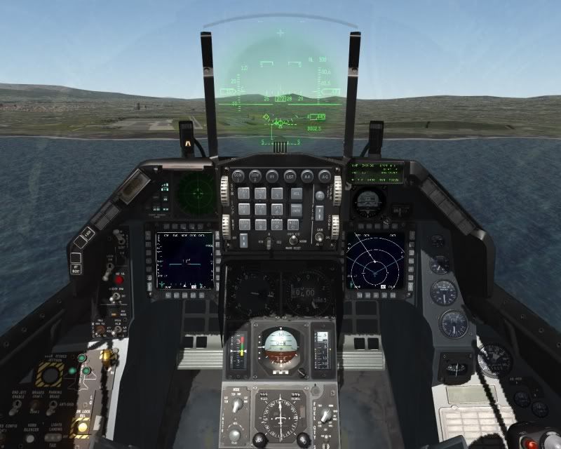
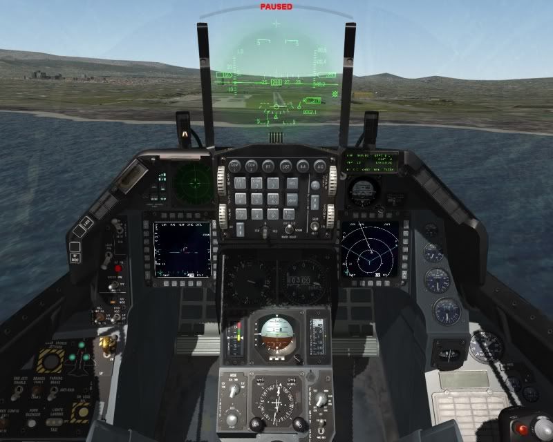
Landing at LGBL using TACAN. Good enough Niko??
-
perhaps a little explanation in flight would not be bad - nice vid M8
-
But then you would hear my (not so nice) voice and not the song.
I’m merely trying to follow the chart. Stay on the arc at 12 miles, cruise at 250knots and follow the signs. Cross radial 117 (i used 118 :() at 4000ft, start your final turn at radial 098 and follow radial 090 all the way in. Cross ANL10 at 2400ft (more or less) and by ANL6 at 1340ft be in landing configuration. Final check at ANL3 at 420ft. Land if runway is in sight.
I was lucky enough not to have to do it all over again
-
flying the chart it´s not that easy - takes a bit of training
but I bet - you made Nikos happy - for shure !!
You did a good job my friend.
ohhhh btw TANAGRA it´s nice to - just did that myself.
Ehhhh Nikos - good job like always - thx for PM´S and support.
-
Thanks mate
-
flying the chart it´s not that easy - takes a bit of training
but I bet - you made Nikos happy - for shure !!
You did a good job my friend.
ohhhh btw TANAGRA it´s nice to - just did that myself.
Ehhhh Nikos - good job like always - thx for PM´S and support.
Hi my good friend Reinhard.
Thank you very much for your kindly words.
Always a pleasure for me to see my friends and the Aegean theater fans (also my friends) happy ;)!
Also i’m glad to be helpful mate.
See you at the next Aegean theater gift, when the time comes…
With my regards.
Nikos. -
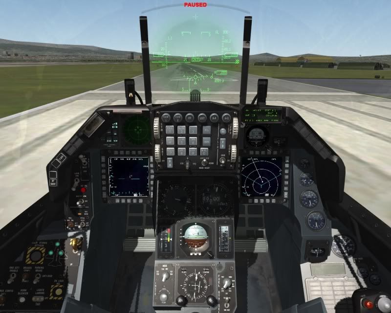
Landing at LGBL using TACAN. Good enough Niko??
Hi my good friend Taki.
Well about your execution of the RWY26 TACAN procedure to Nea Anchialos airbase:- At start you follow the ANL 12 DME arc very close and with correct rate of descent (this it appears at R-117). Almost perfect.
- At ANL R-117 (R-118 as you said, so minor mistake) you were at 4,040 ft. Almost perfect (4,000 ft.) if you had set the R-117!
- At ANL LR-098 it seems that you start the turn 4 degrees sooner, because the CDI line is not centered, it is just 1 deg. below the 1st dot (means 5 deg.).
- At ANL R-090/10 DME you were at 2,360 ft. Almost perfect (2,400 ft.).
- Finally at ANL R-089/2.4 DME and at 450 ft. you started the final turn to 260 deg. heading to runway 26 of Nea Anchialos.
Here you have made the biggest variation of the execution and unfortunately at the most important section of the execution. You should start your final turn at ANL R-090/2.5 DME at 420 ft. So this 1 deg. variation on Radial and the 0.1 DME variation at distance force you to make this S turn to put your aircraft on correct approach.
In general you made a very good execution of the specific approach!
")
But if you have had a low fog or night with rain, obviously you should execute a missed approach and started again.
The key to be very well aligned with runway centerline is to have the CDI centered (max. variation 0.5 deg.) at the DME of the last steerpoin (waypoint) and start the turn to runway heading exactly at this DME!
I see a lot of Falcon pilots try to keep the heading of the chart at final section which is from FAF waypoint to last waypoint, for this approach is from ANL R-090/6 DME to ANL R-090/2.5 DME.
But they forget that in Falcon BMS we have an active wind, so this is a big mistake. The only thing to care is to keep the CDI centered to your final course (for this approach is 270 deg.).
Personally i never try to do this and always try to keep my CDI centered to final course. Then start my final turn EXACTLY at the DME of the last waypoint and this guides me almost perfect aligned to runway centerline (it depends from the wind direction and the strength of it).So Taki congratulations for your try and see you at Tanagra Approach with even better execution. I’m sure you can :p.
With my regards.
Nikos. -
This post is deleted! -
Hi guys.
In order to be more helpful, i will show you how important is to keep the CDI at HSI centered to course of the final segment and turn to runway heading at exactly DME of the last waypoint.
So here i’m at ANL R-090/2.5 DME at 430 ft. (420 ft. by the chart, almost perfect).
Now see my HSI. Almost centered perfect. A very small turn to right needed (less of 0.5 deg.), this remember it at 5th photo.
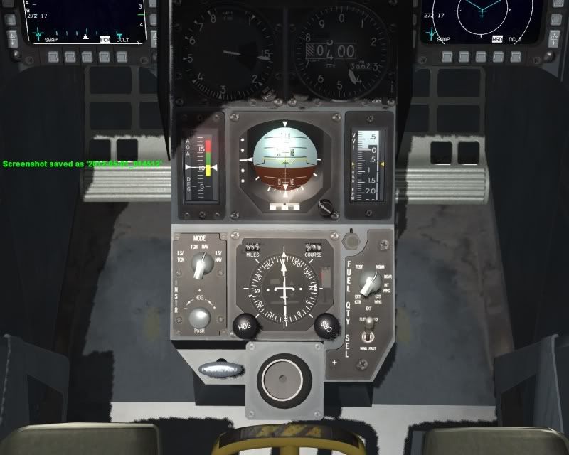
And here is my HUD. Notice that my course is 272 (and not 270) and we have wind at 014 deg. at 4 knots
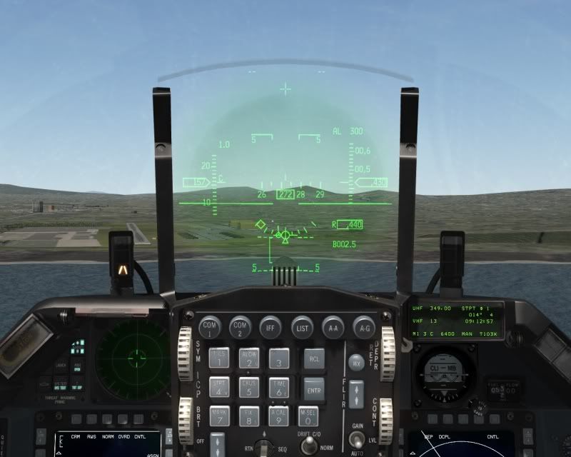
Just after this time i was started my turn to 260 heading, see below
And here i’m level to heading 260, as the chart says. Notice that i’m point to the left side of the runway. If at waypoint of final turn at first photo i were a very little to the right, then now i will pointing to runway centerline. But i’m still very well aligned with runway:
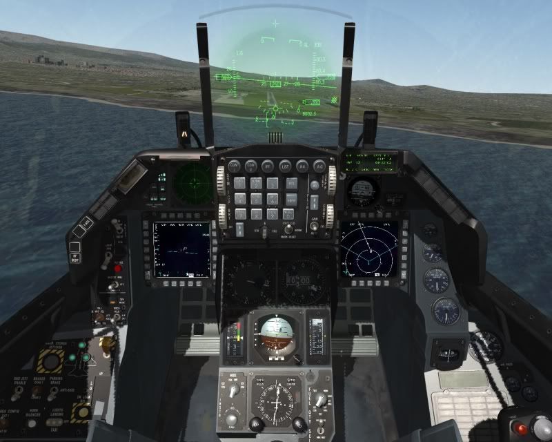
Here just before touchdown
And from external view

So now i think that is very clear to you: The key for a very good alignment with runway centerline is to keep our CDI at HSI centered with course of the final segment (it is 270 deg. and not with the final course, which is 260 for this approach) and not try to keep the heading as the course of the final segment is. Then when we are exactly at DME of last waypoint we start our turn to runway heading, which is the final course that chart gives it.
I hope to help you.
With my regards.
Nikos. -
Dearest Nikos,
you did, indeed you did, true especially for a noob as I sure am. Thanks a lot!

By the way, also your last released did well the job. And not in BMS only - you know well what I mean…;)
Congratulations and best regards,
Gianni.
-
Dearest Nikos,
you did, indeed you did, true especially for a noob as I sure am. Thanks a lot!
By the way, also your last released did well the job. And not in BMS only - you know well what I mean…;)
Congratulations and best regards,
Gianni.
Hi my friend Gianni.
Thank you for your good comments.
Please post at which version of OF or FF you also test the charts and were conformal ;).
See you mate.
Nikos. -
Hi, dearest Nikos.
So you unveiled my best kept secret, didn’t you? So I’ll have to kill you then (nothing personal, it’s only business) :uham:But before doing that, here it’s to you: I discovered it by chance with FF 5.5 (and its following versions).
And I got the same results with FF 6.High respect to you for your skills and your high quality work, and my best regards.
Gianni.
-
LGBL TGR 1P IFR departure
-
IFR landing at LGTG
-
Hi guys.
After i see that a lot of Falcon pilots have difficulties to execute a TACAN approach, i made an IAP chart for Konya airbase in Turkey that is an ILS approach.
Below you can see a preview of the chart that is a pdf file (opens with adobe reader 7.0 and later):
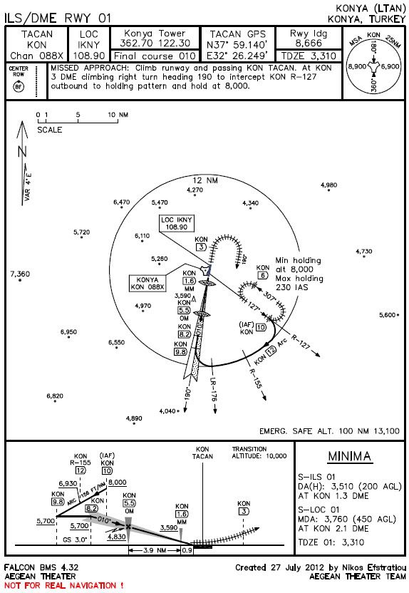
Download the chart (and also the 4 previous) and the updated NavAids for Nea Anchialos, Tanagra, Balikesir and Konya airbases (just to work without conflicts) from here (instructions included in the zip file), file “5_Aegean_charts.zip” 1.42 MB (hit at “Download”):
https://www.box.com/s/7b5491dec97be7f373a1or here (hit at “REGULAR DOWNLOAD”):
https://hotfile.com/dl/164657274/c1fb1a1/5_Aegean_charts.zip.htmlIf still can’t get the zip file, you can e-mail me at: [email protected] to reply to you with the file attached.
Copy the “stations+ils.dat” file to correct location, just like the “Installation instructions.txt” said.
All the data from Tanagra IAP chart, Balikesir IAP chart and Konya IAP chart are conformal with the updated NavAids, but **in the IAP chart of Nea Anchialos the tower UHF and VHF frequencies are different, so even if the IAP chart gives UHF / VHF frequencies: 257.80 / 122.10 please use them: UHF / VHF frequencies: 257.85 / 122.15 for Nea Anchialos! At the Departure chart of Nea Anchialos the UHF / VHF frequencies are correct!
TACAN range for Nea Anchialos is 100 NM, for Tanagra is 100 NM, for Balikesir is 25 NM and for Konya is 40 NM.SOME USEFUL INFOS ABOUT THE PROCEDURES:
1) In order to have a perfect alignment with runway centerline and because of the fact that the DME of the last waypoint has a decimal digit, you must insert GPS coordinates of TACAN station over a steerpoint and make this steerpoint current, so you can turn to final approach course aligned with runway centreline at exactly DME of last waypoint! In this way you will have at HUD the distance from TACAN station with a decimal digit. Also set the Instr mode to TCN so you have at HSI the indications (bearing and distance) from TACAN station and set the appropriate course at HSI, e.g. for final approach segment for Balikesir is 355 and for final approach segment for Nea Anchialos is 270.
2) It is critical that at FAF waypoint (or steerpoint) be at precise altitude with landing gears down and air brakes extended. Then at FAF DME start your descent with 2.5 degrees (for TACAN approaches). There is an intermediate waypoint between FAF and last waypoint (that you turn to final approach course) just for altitude check and minor corrections.
3) Missed approach turn and holding turns must be executed with turn radius of 1.65 DME (N.M.), meaning IAS 250 knots and bank angle of 30 degrees.
4) Turns to join the arc (11,12 and 13 DME) and to leave it, must be executed with IAS 250 knots and bank angle of 30 degrees.
- The charts are under scale, so they are extremely precise. Everything has precise bearing, distance and altitude.If you want to ask something about the procedures, something that you don’t understand, please feel free to do that. My pleasure to help you.
I hope to enjoy also this new chart for Aegean theater.
With my regards and from all other “Aegean Theater Team” members.
Nikos Efstratiou.** -
Hi Nikos,
thank you for the new NavAids - download is made with no issues on my sidecreating a TE tomorrow - stand by for feed back
regards FT