[Release] Grb2fmap - GRIB to BMS Converter
-
I looked at how zyGrib does it and they have their own private server, that of course I shouldn’t use. If anybody can find a public GRIB provider where I can specify the area and parameters via HTTP request I’m happy to code it (PM me). But I couldn’t find any provider either in Google.
Me neither. I’ve looked at wgrib2* and Degrib**, but both aren’t straightforward to use.
*http://www.cpc.ncep.noaa.gov/products/wesley/wgrib2/
**http://www.nws.noaa.gov/mdl/degrib/ -
ain’t there any command line parameters that could be used to download the grib map so that way Grb2fmap could be coded to execute the command and auto insert it?
I searched but couldn’t find any. maybe if someone could contact the zygrib coders and they could implement it in a future version.HOT LIST

System Specs:
i7-2600K @ 4.8 Ghz WaterCooled / 32GB Ram. 2TB SSD/1TB SSD / 20TB HDD Total / GTX1080Ti 11GB DDR5X / HOTAS COUGAR. TrackIR 4 / 3x24" Mon. (res:5760x1200) / Cougar MFD's / Wheel Pedals / Win 10 64 bit.

-
v0.5 is up. Now it is possible to generate files at shorter intervals than the downloaded GRIB’s samples (i.e. Lets you select the time interval between .fmap files)
Please can you also save ‘starting time’ into ini file? Only this last setting is not saved;-)
Cheers Obi1Request honoured on v0.5
 You can set the default value in the INI. It is not saved from the app, however.
Me neither. I’ve looked at wgrib2* and Degrib**, but both aren’t straightforward to use.
Those are programs to decode GRIB data, but they don’t provide any means to download those files.
zyGrib downloads the data from its own private server, that generates the custom GRIB file via HTTP request. However it is their own private server and I don’t think they would welcome others using it.
If I cannot find a public provider I will e-mail them asking for permission and see what they say.
-
work stops
stopped
system windows 8
-
Would need more info such as the .grb (file) if any or even better a crash dump…
EDIT: Make sure you selected all the required parameters in the GRIB file as in this picture
-
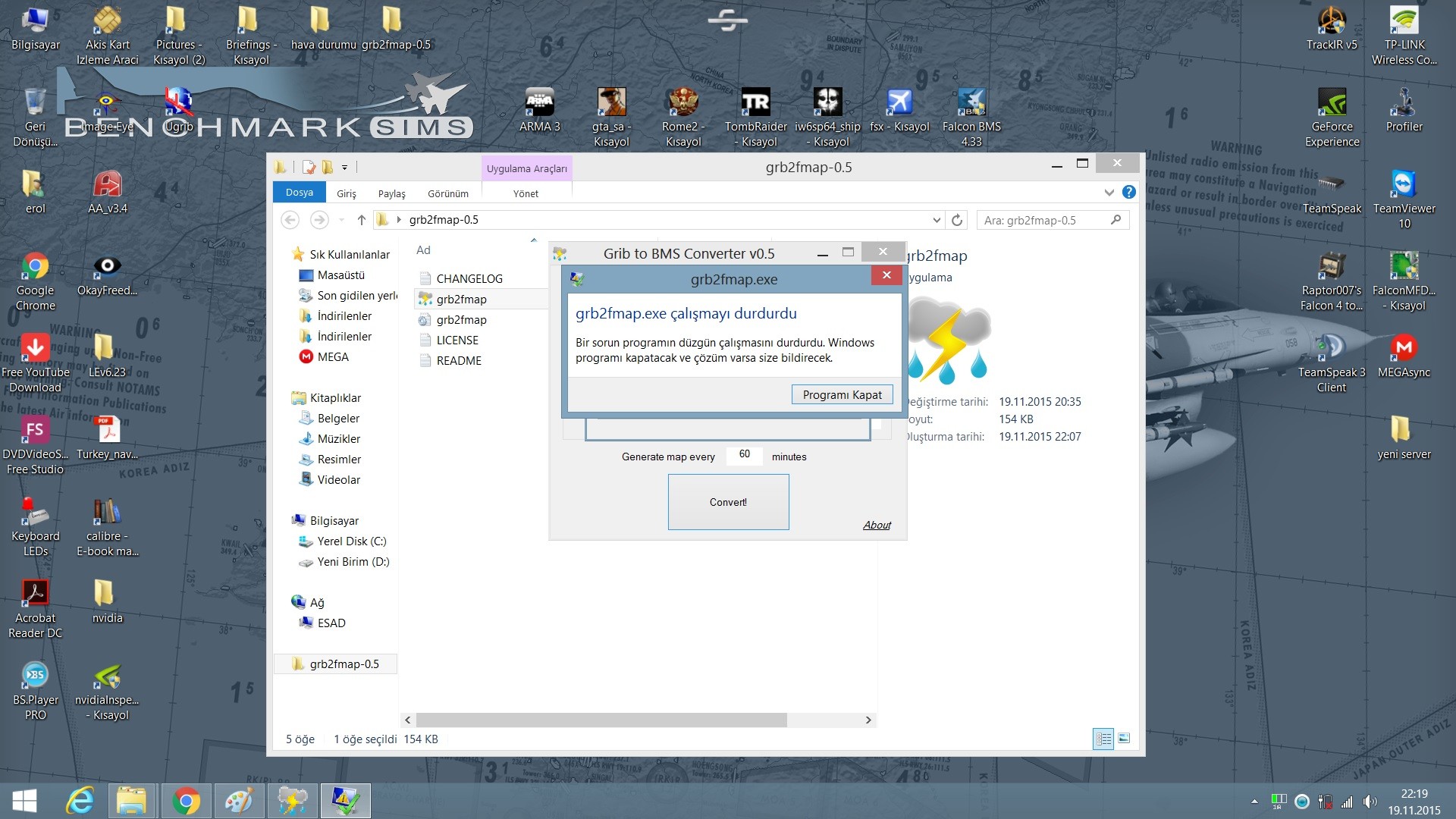
Hi for me it just fails to start, it just shows the symbol for windows is thinking and then nothing not even in resource management.
Windows 10
v0.5a -
Running perfectly on fresh Win 10 virtual machine here. Would need more info. Check that you have visual c++ re distributable 2013 x86 package installed (but you should get and error if it were missing…)
-
GRIB output LON/LAT for Israeli Theater are:
LAT: Min 35N, Max 25N (yeah, it’s reversed from some reason)
LON: Min: 30E, Max 40Eyou can verify alignment with wind and temperatures over the red sea,it stands out.
-
I made a recent set of 60 minute FSMAP for Korea and it’s working great. Don’t worry if you get “loaded autosave.fsmap” showing because the save file FSMAPs are just snapshots of the current weather at the time was made and will update at the next auto name in the folder.
One of the best hidden benefits is because of the pressure-temperature is real world based the F-16 altimeter is much more accurate vs. altitude than the fictional weather before.
-
I made 10 day weather , 3h interval. Works nice , i took weather info from Thailand are. There was many nice storm areas
")
Win10 64bit
0.5 works nice. -
keep in mind that in MP each map loading is a huge traffic
of data -
keep in mind that in MP each map loading is a huge traffic
of dataYes , must take look how much it takes BW.
I have autoupdate on, but will map load when in 3D ? Or only in 2D ?
-
keep in mind that in MP each map loading is a huge traffic
of dataCould you please give some metrics on the huge traffic?
And another would be: this traffic would be only from host to client. Right?HOT LIST
System Specs:
i7-2600K @ 4.8 Ghz WaterCooled / 32GB Ram. 2TB SSD/1TB SSD / 20TB HDD Total / GTX1080Ti 11GB DDR5X / HOTAS COUGAR. TrackIR 4 / 3x24" Mon. (res:5760x1200) / Cougar MFD's / Wheel Pedals / Win 10 64 bit.
-
keep in mind that in MP each map loading is a huge traffic
of dataYep, probably it is worth adding a note to set the map generation interval sensibly for MP sessions
-
First of all great tool Ahmed. Thank you so much.
Secondly can i just check I am understanding correctly. The video you posted in post #1 is a time lapse of the ~200 or so fmaps that were created when you coverted the GRIB files? In other words, there is no way to get Weather Commander to run through all the maps in sequence as in your video? This is simply done via the Falcon UI with the AUTO UPDATE MAP feature?
Also is contained in the GRIB file somewhere what the speed and direction of weather travel is? Thanks.
-
The timelapse was created with a script that sent mouse/keyboard commands to WC to load the maps and take a screenshot of each. AFAIK there is no other way of doing this.
To load the sequence automatically into BMS you only need to place the files into the theater’s WeatherMapsUpdates directory (further info in BMS manual).
And no, I am afraid that the GRIB file doesn’t contain weather movement data, and any attempt to try to programatically analyze such a complex thing as real world weather movement patters would probably end up in disaster. That is why I added the option to get lower map generation intervals. You can always set it manually by looking at how the weather evolves from file to file. This may actually be a very good idea to do in multiplayer games: just manually load the first file and set the movement data.
-
Thanks Ahmed.
-
Well this is an amazing little tool!
Thanks Ahmed, your work will be much appreciated
")
-
Heeeeey my friend, this is my error.


I’ve gone down the library but gives this error.

Cheers
-
Heeeeey my friend, this is my error.
http://i888.photobucket.com/albums/ac81/Toquemao/1_zps2p0ihzd3.jpg
http://i888.photobucket.com/albums/ac81/Toquemao/2_zpserktjpew.jpg
I’ve gone down the library but gives this error.
http://i888.photobucket.com/albums/ac81/Toquemao/3_zpsnh1vsg3i.jpg
Cheers
Edited because Ahmed has posted the correct solution below.


