WIP - Guam Theatre
-
Dear Demer, I always knew of your good taste, also with music now… Jefferson Airplane on their first times, am I saying it right? Ehi, guys… that’s still ‘Music’, you know

With best compliments for your choice, Demer, and regards,
-
So another weekend of Falcon……
And onto the next “Land Mass” feature in this Theater…GUAM!!!..
Real Life picNew Terrain pic
As close as I can get……LOL…well not exactly…CE provides you the ability to quickly produce terrain based on Height Maps. As well, it provides you the ability to place buildings (Two Polys if you know how the Rules play, we will make buildings out of them later in the process) at the correct elevation on the Terrain. Also it will export a .dxf of the road network…Hmmm why does demer need that??? That is our “Thousand Point’s of Light” needed to produce the street lights!!!
cheers,
demer -
Sooo……going forward a bit:
Lets just say that CE affords us the ability to create Airports\Airbases at the correct elevation over the terrain? It does. Now, let’s just say that, CE affords you the ability to "SQUASH the mesh to L2 Terrain Height……It does while still retaining kinda L0 elevations……HMMM…??? and lets just say that you can take your beautiful PR image of said terrain and “Slice it into Tiles”…you can. And lets just say you can “Path” the Road Network that comes with CE to your new Tiles over the L2 wireframe that now matches the CE terrain, you can. And what if, lets just say that CE will build Lo-Poly cities\buildings at the correct elevations that work FPS wise in Falcon… it will with the right rules:
Just say’n……
More to come outta’ dis…4sur…
demer -
That’s the spirit…
U can autoplace lamp lights on those streets.
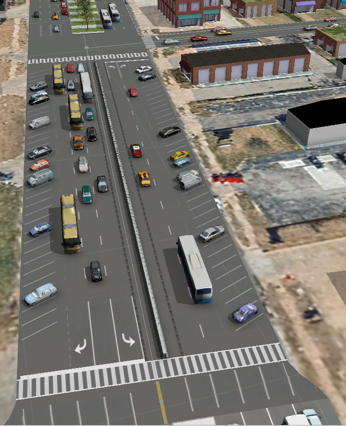
U can also place street furniture… signs trash buckets benches bus stops people cars trees parkings and real streets network, not just the path - place of the streets but junctions and markings on the streets, foot crossings, lanes, directions.
Redlands tutorial and source - example files have all those and how to:
https://www.esri.com/~/media/Files/Pdfs/library/brochures/pdfs/cityengine-example-redlands.pdf


And cause some would say no way Falcon engine can’t handle all those.
Well I don’t believe this will be the issue after Mortesils tool.
U can have a LOD1 with disgusting details (all low poly still, as you see in the images). Maybe 2 versions. One basic for the masses and if your pc can handle it there could be a second version for those.Maybe a structure like high res textures would be nice for the 3D Database… So if you have a killer pc not to go to frenzy to load - import whatever those high poly models but just a selection (for the user) and for the theater creators a different handling or a different folder. So at the same time provide high poly and BMS prerequisites and the user chooses whatever he wants
Hmmm is Mortesil looking??? :lol: we don’t have the basic tool and I keep asking for additions and changes… yea I know I’m crazy… maybe as a structural and for future needs this idea would be better “if” considered a good one or needed to be done from the very beginning as it would mean major database change…
what you save is time…
Yeap airports also… it saves you a great amount of time. doesn’t it?
For special buildings you can build them directly in CE as you have the tools and the underlying photo as reference for size or even the topo map image")
http://desktop.arcgis.com/en/cityengine/latest/tutorials/tutorial-14a-basic-polygonal-modeling.htmIf we had a free account to the arcgis database… oh man… the horror!!! :lol: :rofl:
It would be just textures issue and time to import things and stuff objects to Falcon database to death… It would unleash hell :lol:HOT LIST

System Specs:
i7-2600K @ 4.8 Ghz WaterCooled / 32GB Ram. 128GB SSD/1TB SSD / GTX1080Ti 11GB DDR5X / HOTAS COUGAR. TrackIR 4 / 3x24" Mon. (res:5760x1200) / Cougar MFD's / Wheel Pedals / Win 10 64 bit.

-
Interesting stuff…
How do you match RL positional data with Falcon’s fake projections? Are you shifting everything by hand or is there some automated procedure?
And 1 more thing please. Is it possible (As start) to export RL buildings locations from such tool with the following info:
1. Horizontal position - Say in RL LAT/LONG
2. Size (Assume rectangular shapes only, so say X * Y in feet/meters/inches/human-arms/whatever)If yes then how painful can that be to export say a single KTO city/village ?
-
About positioning it to the correct place well no need to ask. u can export the area as image from Terrain Editor (with roads viewable maybe and already falcon objects
) and then you align them. In Demers case u scrap everything from Falcon if it’s just a terrain tile and you place the city where you like. Demer here has the whole island in 3D model so he places the city in the exact correct place as in real.
for heights alignment he can use the already used heights as the ones he used to create the island, but I believe you don’t want that.Edit: look here: https://www.benchmarksims.org/forum/showthread.php?12073-3D-Cities-for-Falcon&p=171102&viewfull=1#post171102
lat long well cityengine uses real ones and you declare which kind so that all your GEO sources to be in synch or while u import sources you must declare the correct one and then it places them correctly.
about the sizes as you ask them well it can export many things but not in the plain context you ask for it.
https://cehelp.esri.com/help/index.jsp?topic=/com.procedural.cityengine.help/html/manual/export/export_toc.htmlThe python report export can give you the XY but it doesn’t state clearly the size dimensions. Have to look in to it.
The XY of the buildings you can get them and from the OSM export. So maybe this is more efficient for Falcon procedural data? Sure ti will need align on the coordinates but this must not be an issue.
How painful is to export a village or a city? Well you can time me. :lol:
Joking.
I can do it for you if you like record it in camtasia and upload the whole process from zero to 3ds max.Pick a city or village of your like and let me know.
Just from rough experience I would say from one hour to maybe a few days. Depends what you want.
The creation and export is not the pain.
The pain factors are preperation:
1. Terrain tiles needs align with jgw
2. Heightmap ok buildings will align perfectly with falcon terrain elevation. Hmm how can I learn max and min height of a theater height map? Sure can do for a town area.
3. Landuse map from gis or manual (industrial urban suburbs center skylines)
4. Obstacle map from terrain editor with objectives features view or manual. That way falcon buildings will blend naturally. Also sea lakes rivers and falcon roads will be perfectly respected.
5. Roads network from OSM ( consider dxf for grouping - separating areas to easily import and manipulate in Falcon) reminder: maybe from QGIS will work.
6. Landmark buildings from free models, must blend with obstacles map or manual edit.
7. Facades must be square, maybe I should talk with WaveDave and review his remarks on texture materials. Must create one set per Landuse. Also one extra set for each for night.
8. Rules per Landuse per day night?
9. 3d Roads must not be used. (for poly count reduce, or they can be used as a separate feature)
10. Destroyed models.Now the most painful is the textures library and the rules.
if you want to more easily transfer them and not render to texture in 3ds u must create the library as squares and use this in CE. CE exports and the uvmapping and materials. Doesn’t use dds but I believe this will not stand in the way. maybe even and with a script in 3ds max you can make the mass switch.
Rules are kinda simple once you get used to them. Sure you will have some places that things will look strange but those are minimal and depend on the source detail. For example in Guam you have each building place. For my home town you have the whole block of buildings. This is good and bad.
if you have the exact buildings brake down (LOTS) then its good for realism and eyekandy but results to actual number of buildings which might mean too many buildings.
if you don’t have the exact buildings LOT but one LOT for the whole block meaning like 10-15 buildings per block you can have like 5 to 10 which is bad for realism but lighter for the gfx.Still on both you can have the correct real streets network.
Now if we have to respect the falcon roads network (for the known reasons) u have to draw them (easy the are not so complicated and you can have the image underneath as reference) (maybe if the source exists can be imported?).
For the heights u can export them from Falcon and use it in CE… CE has an option when it creates the models to snap them to the terrain. Ofcource if you done it in real height data and then do it like that (falcon Heights) well makes you laugh cause it looks ridiculous.
HOT LIST
System Specs:
i7-2600K @ 4.8 Ghz WaterCooled / 32GB Ram. 128GB SSD/1TB SSD / GTX1080Ti 11GB DDR5X / HOTAS COUGAR. TrackIR 4 / 3x24" Mon. (res:5760x1200) / Cougar MFD's / Wheel Pedals / Win 10 64 bit.
-
You have gone too far

I don’t need 3D objects created… I only need data, e.g like in or similar to the format I posted above. But since you said OSM should be easier for that, then I guess that’s what I need.
But, I guess the main problem is projection, as I need a special one. Not Falcon fake projection, but also not that popular Google style projection… I actually need to check that. So NM for now.
Thanx!
")
-
You have gone too far
I don’t need 3D objects created… I only need data, e.g like in or similar to the format I posted above. But since you said OSM should be easier for that, then I guess that’s what I need.
But, I guess the main problem is projection, as I need a special one. Not Falcon fake projection, but also not that popular Google style projection… I actually need to check that. So NM for now.
Thanx!
projection as?
3ws?
HOT LIST
System Specs:
i7-2600K @ 4.8 Ghz WaterCooled / 32GB Ram. 128GB SSD/1TB SSD / GTX1080Ti 11GB DDR5X / HOTAS COUGAR. TrackIR 4 / 3x24" Mon. (res:5760x1200) / Cougar MFD's / Wheel Pedals / Win 10 64 bit.
-
projection as?
3ws?
Projection of terrain. Falcon projection is “fake” as it treats the earth grid as it was made of straight lines…
-
Well… Maybe apply the same conversion as is now.
What I mean besides heights u can place them on flat terrain. In falcon, as I see it, the code elevates the object and shows above the terrain.
But u must place them one by one. Killer.
So the code must distinguish each and place it above the terrain with z (bottom) of object snapped to the terrain z (top).
I believe this already works for the trees.
So create more instances like trees… Use different 3d object source declaration. Update terrain editor or create new tool for manipulation…
Done.[emoji38]
So easy… few lines that can result to months for implementation and testing.
Since I mentioned 3ws… Ain’t there a way it could be used and implemented for easier manipulation? Code and user wise.
Just in case 3ws is used for 3d in web.Στάλθηκε από το MI 5 μου χρησιμοποιώντας Tapatalk
HOT LIST
System Specs:
i7-2600K @ 4.8 Ghz WaterCooled / 32GB Ram. 128GB SSD/1TB SSD / GTX1080Ti 11GB DDR5X / HOTAS COUGAR. TrackIR 4 / 3x24" Mon. (res:5760x1200) / Cougar MFD's / Wheel Pedals / Win 10 64 bit.
-
Projection of terrain. Falcon projection is “fake” as it treats the earth grid as it was made of straight lines…
The “WORLD IS FLAT”….IN fALCON…run and hide!!! ROTF LMAO ……How many times have we YET to explain it to peeps???
BTW nice to see your banning butt again, guess your interested in this little “out of the Box” thinking?
So a LITTLE more food for thought……whilst going through this learning curve:
As you see I am NOT ignoring the possibilities for other theaters. That is just a 10km sample of an area in N.Korea.
It is a can do.demer
BTW Gilmans idea of the Falcon world was with Universal Transverse Mercator coordinate system I believe, which is FLAT….and Old, just like me…LOL!
-
Interesting stuff…
How do you match RL positional data with Falcon’s fake projections? Are you shifting everything by hand or is there some automated procedure?
And 1 more thing please. Is it possible (As start) to export RL buildings locations from such tool with the following info:
1. Horizontal position - Say in RL LAT/LONG
2. Size (Assume rectangular shapes only, so say X * Y in feet/meters/inches/human-arms/whatever)If yes then how painful can that be to export say a single KTO city/village ?
CE provides the advantage of LOCKING an Object to the Terrain in two ways: 1 per Real World coords and 2 Object space …choose 2 for Falcon. The object Location (XYZ) does not change then.
As far as RL position, I had already projected the Land Mass at UTM 55N to match my MAP file in Guam.Cheers,
demer -
The “WORLD IS FLAT”….IN fALCON…run and hide!!! ROTF LMAO ……How many times have we YET to explain it to peeps???
Hey, I don’t always know if you are laughing or not, nor which direction you think is the right one, so I’ll just say the “fact”:
Falcon world IS flat, that’s the only way that the X/Y values of all Falcon entities can work, good luck in changing to real LAT/LONG, that I think will never happen.guess your interested in this little “out of the Box” thinking?
Yea I’m interesting in everything related to terrain… you have no idea how much
So a LITTLE more food for thought……whilst going through this learning curve:
As you see I am NOT ignoring the possibilities for other theaters. That is just a 10km sample of an area in N.Korea.
Cool… I assume that’s 30m resolution data.
It is a can do.
Can do export… but the more problematic to do is the code that can render that (or something else “Good enough”) :mrgreen:
BTW Gilmans idea of the Falcon world was with Universal Transverse Mercator coordinate system I believe, which is FLAT….and Old, just like me…LOL!
Yes UTM is probably the best way to translate Falcon flat X/Y to “real” Heightmap positions, then all that is needed is to take the reference position (On earth grid) that the given Heightmap use, and apply the same export to other data (Like e.g buildings), but since I’m not managing the “export of data process” (Unfortunately) myself, I don’t really know to tell the projection used (for what I need)…
CE provides the advantage of LOCKING an Object to the Terrain in two ways: 1 per Real World coords and 2 Object space …choose 2 for Falcon. The object Location (XYZ) does not change then.
As far as RL position, I had already projected the Land Mass at UTM 55N to match my MAP file in Guam.Yea that makes sense… So I just need to get my “UTM ***” needed projection in order to get data
-
“Hey, I don’t always know if you are laughing or not, nor which direction you think is the right one, so I’ll just say the “fact”:
Falcon world IS flat, that’s the only way that the X/Y values of all Falcon entities can work, good luck in changing to real LAT/LONG, that I think will never happen.”I laugh a lot anymore when it comes to Falcon, for real. Not as serious about Dev’ng as I was once required to be. As far as what I think is the right direction…thats easy, it doesn’t matter what I think. Freds tool sez’ EW\NS\WE\SW or something like that…ICRCATM…LOL!!! There’s your laugh
The “FACT” is correct and peeps Dev’ng in this world need to understand it!
“Yea I’m interesting in everything related to terrain… you have no idea how much :)”
K maybe we can communicate again without Falcon politics?
“Cool… I assume that’s 30m resolution data.”
Correct 30m @10km x 10km from SRTM data. The Data set is spotty though……be careful. I think ASTERS Metadata may be better but have not investigated yet. Still busy POC’ng this in Guam.
“Can do export… but the more problematic to do is the code that can render that (or something else “Good enough”) :mrgreen:”
Yeah, I don’t see Renderman around the corner anytime soon….ROTFLMAO…BUT in the next post you will see that Falcon, as is, with DX will render correctly, just gotta figure out how I got there…:embarassed:…LOL, it will come back to me.
“Yes UTM is probably the best way to translate Falcon flat X/Y to “real” Heightmap positions, then all that is needed is to take the reference position (On earth grid) that the given Heightmap use, and apply the same export to other data (Like e.g buildings), but since I’m not managing the “export of data process” (Unfortunately) myself, I don’t really know to tell the projection used (for what I need)…”
Hmmm……Guess I’m misleading again per some others opinion of me years ago. So instead of me trying to help you LEARN the tools and how they work, which I think you already know after all these years, I will state this. I only use the UTM for the MAP file and TOD, the rest exist’s in the Object World of Falcon. I do NOT use Real World Mapping with the other tools. They are all Zeroed to the object world.So that being stated, all we need is the X\Y\Z of the shapes\models on the FEATURE model of the Terrain|Landmass we are working with…
“Yea that makes sense… So I just need to get my “UTM ***” needed projection in order to get data”
Yes, but when Projecting it use No Projection “RAW Data in feet or meters in CE” that way you can have CE import the .osm data anywhere on the grid. Then move that Data anywhere you’d like (puts us back to x\y\z where we need to be for Falcon)
Kind regards and Enjoy the next post!!!
demer -
Been a Falcon second but I think we may have this down, 16,106 buildings on Guam Island and NO FPS HIT!!!
:mrgreen:Now mind y’all I still get an FPS hit from this pit…DUNNO…why, that’s on the Devs.
But that’s OK we still smoothEnjoy the Pics and once I figure out how we got there I’ll pass it along…LOL
demerBTW New and better imagery of the Landmass is coming thanks to Vags
-
All these buildings do they have their relative shadows each?
Are they close the airport?
Can you post a screenshot in pit in taxi?Thank you in advance
-
All these buildings do they have their relative shadows each?
Yes
Are they close the airport?
Well you can see the airport in the second screenshot.
HOT LIST
System Specs:
i7-2600K @ 4.8 Ghz WaterCooled / 32GB Ram. 128GB SSD/1TB SSD / GTX1080Ti 11GB DDR5X / HOTAS COUGAR. TrackIR 4 / 3x24" Mon. (res:5760x1200) / Cougar MFD's / Wheel Pedals / Win 10 64 bit.
-
OK so CE is eventually exporting OSM data? I guess that’s understood now. So no other way to do what I want but to learn how to export OSM data
Been a Falcon second but I think we may have this down, 16,106 buildings on Guam Island and NO FPS HIT!!!
:mrgreen:16K is a huge number, but 16K separated building objects will FOR SURE cause a FPS hit, some FPS hit. It doesn’t matter even if you draw identical boxes and untextured. Assuming this is BMS you are showing, 16K buildings mean 16K draw calls, which will cost ~2ms on GPU alone, and so many draw calls, the CPU will also spend some cycles for preparing those. 2ms for 60 FPS means ~6-7 FPS drop at least.
Here are 16K “buildings” all in view (Identical untextured cubes actually), these cost ~2ms with 16K draw calls, but with single draw call, only ~0.17ms :mrgreen:
So if you have no FPS hit, there are 2 options:
1. A very small number of these buildings is in view and actually rendered (As the engine will cull models not in frustum)
2. The 16K buildings are 1 objects and drawn in a single draw call –> Make sense for no FPS hit.Cheers!
-
No. CE doesn’t export OSM data.
OSM has export functionality and CE has import functionality for OSM exported data. CE uses a simplistic interface to import the OSM data to CE.
You can export OSM by web manually or by using their API or other GIS tools.
Now CE by using it’s integrated python engine can report the building positions which actually got from OSM data.I’m 1000% Sure those 16000 buildings are one object.
And one of the reasons I say all those years that this compromise is needed.Στάλθηκε από το MI 5 μου χρησιμοποιώντας Tapatalk
HOT LIST
System Specs:
i7-2600K @ 4.8 Ghz WaterCooled / 32GB Ram. 128GB SSD/1TB SSD / GTX1080Ti 11GB DDR5X / HOTAS COUGAR. TrackIR 4 / 3x24" Mon. (res:5760x1200) / Cougar MFD's / Wheel Pedals / Win 10 64 bit.
-
From my experiences done in POH in Gibraltar area, (thanks to Arty’s teachings
) it is actually possible and relatively easy to create huge cities as a single objective and, in fact, provided we create very low poly buildings, the fps impact is close to zero, even on a hot campaign environment.What I found hard is to match each building elevation with the terrain elevation, but I’m sure you guys have figured a simple way to do it already…