How to use objects to represent small boulders?
-
I guess MEA is rather for mission planning, than 3d AI flying.
-
Wish they would re-implement L0… Must of had a really good reason to globalize L2. Heard it had something to do with fartiles, but not sure.
-
First : don’t draw any conclusions from TFR. TFR in 4.32 is an arcade thing and probably badly coded.
You will have to wait 3 to 4 weeks and yes then I could confirm that TFR sees objects.
Anyway bad idea to use objects instead of terrain for many reasons
-
In my tests on the same thing (there is and a thread) was said that mea and thr are needed only for slow movers aka helicopters.
IIRC it was mav-jp -
I apologize for my English. I use a translator.
Thank you very much for the advice, opinions and solutions provided.
All the problems generated by the use of objects to define the terrain is something that concerns us. We do not want an object to generate conflicts with AI behavior, radar, seasons, etc. next to an airport (where there is just planes flying at low altitude).
While these conflicts exist renounce the Rock of Gibraltar in HD topographical.
-
In my tests on the same thing (there is and a thread) was said that mea and thr are needed only for slow movers aka helicopters.
IIRC it was mav-jpif it is true (i remember your thread a bit), then supersonic Tornado IDS is better in NOE than AH-64… :–)
MEA is very sparse… L4 or L5 or something IIRC -
Well L0 as said is an overkill cause it’s the whole terrain.
On the other hand the L2 is to simple.
with 3d objects as far for mountains and some land marks or small areas like canals and near airport hills and etc where u have to level the terrain so that airplanes will not crash is a good solution to go 3d.
Now about radar and other stuff I don’t know.
Mav says TFR will be ok in 3-4 weeks so this is a good thing. Probably will work and for radar… so if that is the case then they will work fine.
Also the 3d doesn’t have to be detailed to death… using just a hundred of polys u can have a wonderful result don’t forget pro optimizer modifier in 3ds max.about teraforming there are many approaches.
I believe I posted a video with Gibraltar rock …
second is with splineand
third with unity and world and terrain composer.HOT LIST

System Specs:
i7-2600K @ 4.8 Ghz WaterCooled / 32GB Ram. 128GB SSD/1TB SSD / GTX1080Ti 11GB DDR5X / HOTAS COUGAR. TrackIR 4 / 3x24" Mon. (res:5760x1200) / Cougar MFD's / Wheel Pedals / Win 10 64 bit.

-
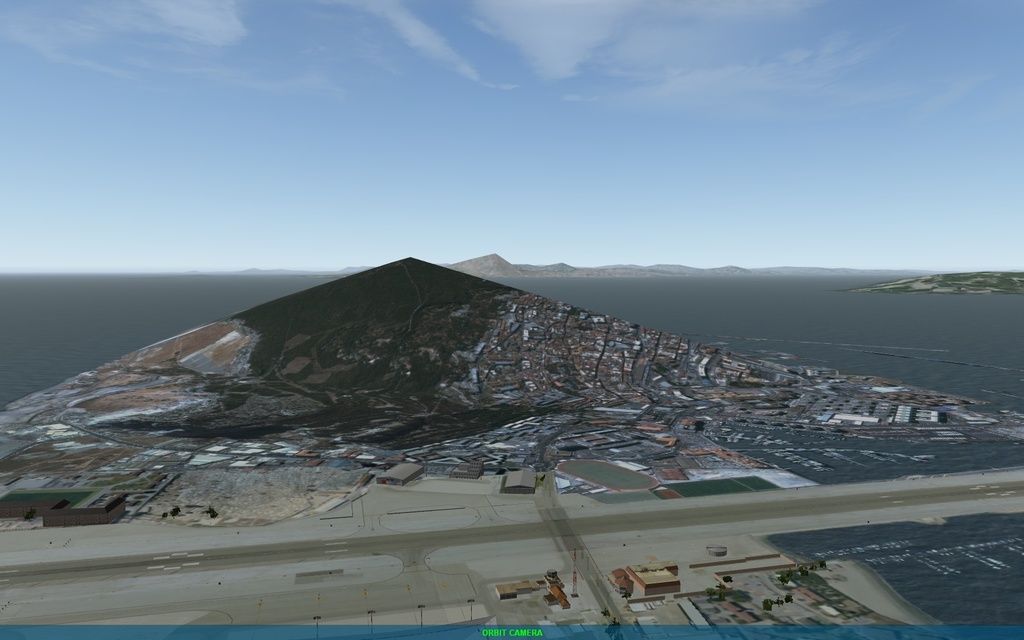
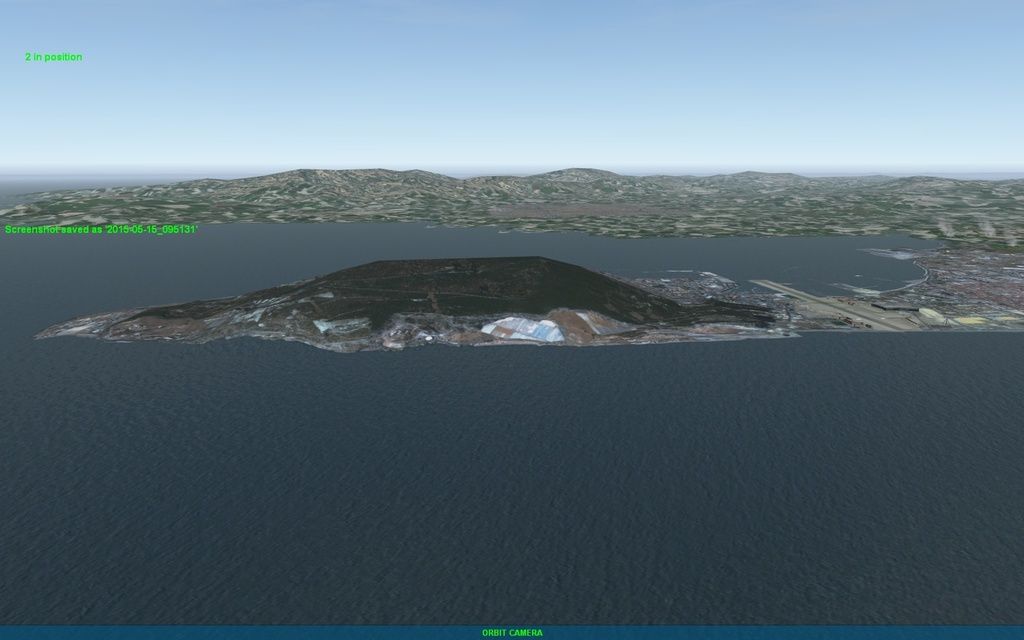
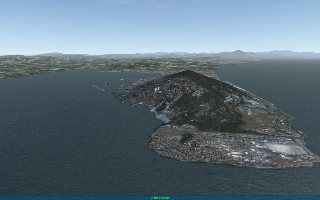
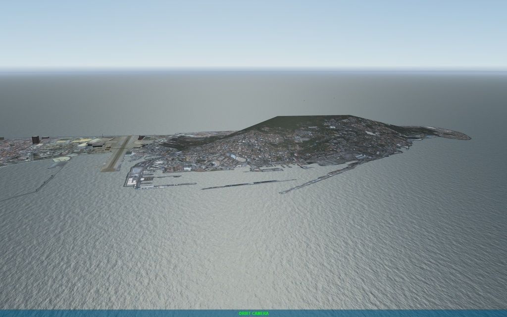
Finally we have sought an alternative and easier solution. Although not the most true to life.
We have edited the textures of Gibraltar slightly to stretch coast to the uneven terrain. In this gap he appeared before the high ocean, creating an ugly effect.
The Rock of Gibraltar is not 100% realistic topographically, but the ocean is flat now.
I think it’s a license that improves the final result.
Before:
Now:
-
Very good approach but it’s a shame for the landmark to be represented that way… It’s something unique…
HOT LIST
System Specs:
i7-2600K @ 4.8 Ghz WaterCooled / 32GB Ram. 128GB SSD/1TB SSD / GTX1080Ti 11GB DDR5X / HOTAS COUGAR. TrackIR 4 / 3x24" Mon. (res:5760x1200) / Cougar MFD's / Wheel Pedals / Win 10 64 bit.
-
Well done